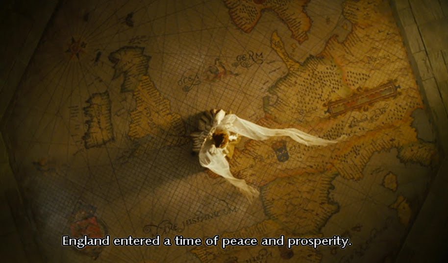
the World is under my feet

the World is under my feet
screen shot from the movie 'Elizabeth the Golden Age'

Sunday 18 August 2013

London Coronation Guides & Maps 1952

Title: London Coronation Guides & Maps
Publisher: A.P.S.O. Ltd and GEOGRAPHERS' MAP Co. Ltd
Year of publish: March 1953
Place of publish: London
Edition: 1st
ISBN: Nil
Size: 17.8 x 11.5 x 1.1
Condition: Overall is excellent, only the cover loosen from the spine, simple book binding conservation technique can solve
Date of purchase: August 2013

Maps contained:
1] Main roads of Central London
2] The West End
3] Knightsbridge and Kensington
4] Subway map of Central London
5] Bus routes: Central London Area
6] West End theatres
7] West End cinemas

When I received the package, I found there is something strange: why is a map as thick as a booklet? Okay, it was a midnight and I would open on the next day.

huh?! Why it is a booklet?! Wow. There are many extra information about the Coronation. I have no idea whether this booklet was an official one but it covered a wide range of information about the Coronation and the city itself. It moreover contains 15 coloured and black-&-white photographs of the Royal family, Royal castles, prominent architectures as well as jewelries and artefacts of the Coronation. 

Why I would buy this booklet in which I though it is a map? It is because I have bought a pictorial 'Route Map of the Coronation of Her Majesty Queen Elizabeth II' published by Master Maps Ltd in 1953. This booklet is a good reference.

The contents:
Part I - London sights (General information, Places of interest in and near London, Tour of London)
Part II - London maps (mentioned above)
Part III - London shops (General information, Shops tabulated)
Part IV - London restaurants (General information, Restaurants tabulated)
Part V - London Services (Services listed)

This book is not exactly focused on providing very detailed geographical information but a general information of the city. In 1953, the 'All-figure dialling' system' (Wikipedia) was being used, for example, the restaurant Rules, its telephone number was 'TEM 5314' (now 020 7836 5314); and the phone number of the famous bookstore Foyle, W & G., Ltd. (now Foyles) was 'GER 5660' (now 020 7437 5660).

'The simplest way to find an address on the detailed Sectional Maps in this books is by reference to the dialling letters of its telephone number. These letters indicate the telephone exchange that serves it and appea in the area covered by the exchange shown on the maps. Thus, the telephone exchange and number of the American Consulate in Grosvenor Square in GROsvenor 9000. Its position will therefore be found on the detailed sectional maps in the area marked GRO.'

It is interesting that the price range of the Rules restaurant in 1953 was only 'Medium' but 60 years later, not many people would say its price is moderate unless you are a very better-off person. I had a lunch there in 2008 and it costed me around £80.


 cover

 
i personally think the Queen is beautiful

 
Main roads map of Central London

The West End

Bus route Central London Area

West End Theatres and Cinemas

Advertisement in 1953 
Monday 20 May 2013

London map on hanky with Chinese title

Title: London of Vogue
Publisher: Viesca
Year of publish: 2011
Place of publish: China
Inset(s): N/A
Material: Cotton
Size: 47cm x 47cm
Condition: New
Version/Correction: N/A
SBN (if any): N/A
Date of purchase: March 2011
Purchase cost: RMB80

I had not tried to purchase via taobao.com (kind of 'Ebay' in China) as I did not have an account and confidence to shop in Mainland China. But one day I just browsed this website for fun and saw what I could find related to London maps. And I found a handkerchief with a pictorial London map on it. Therefore I asked my University classmate to purchase one for me.

The most interesting character of this cotton map is that there are some prominent streets and architectures printed with simplified Chinese words:

The Chinese characters shown here are traditional Chinese.

From the left to right, top to bottom:
1] Zoological Gardens = 倫敦動物園
2] Regent's Park = 里真特斯公園
3] Albany Street = 奧爾巴尼街
4] Hampsted Road = 漢普斯特德路
5] Eversholt Street = 埃弗肯特街
6] British Library = 大英圖書館
7] University College = 倫敦大學學院
8] Marylebone Road* = 馬里爾伯恩路
9] Mdme Tussaud's Planetarium = 杜莎夫人蠟像館
10] Pollocks Toy Museum = 波洛克玩具博物館
11] British Museum = 大英博物館
12] Clerkenwell Road = 克利爾肯韋爾路
13] Oxford Road = 奧克斯弗德街
14] New Oxford Road = 新奧克斯弗德街
15] Soane's Museum = 約翰 索恩爵士博物館
16] Royal Courts of Justice = 皇家法院
17] St. Paul's Cathedral = 聖保羅教堂
18] Guildhall = 市政廳
19] Swiss Re Tower = 瑞士再保險塔 
20] The National Gallery = 國家美術館
21] Royal Academy = 皇家藝術院
22] Piccadilly Circus = 皮卡迪利廣場
23] One Canada Square = 加拿大第一廣場
24] Cleopatra's Needle = 克麗歐佩特拉方尖碑
25] Millennium Bridge = 千禧橋
26] Tower of London =倫敦塔
27] Tate Modern Gallery =泰特現代美術館
28] Southwark Cathedral = 南華克大教堂
29] Wellington Arch =威靈頓拱門
30] Queen Victoria Memorial =維多利亞女王紀念碑
31] Horse Guards = 海軍拱門
32] London Eye (Millennium Wheel) = 倫敦眼
33] Buckingham Palace = 白金漢宮
34] Waterloo Road = 滑鐵盧路
35] Westminster Abbey = 威斯敏斯特教堂
36] Houses of Parliament = 國會大廈
37] County Hall = 郡政廳
38] Guy's Hospital = 蓋伊醫院
39] Lambeth Palace = 蘭貝斯宮
40] Victoria's Street = 維多利亞街
41] Westminster Cathedral = 西敏大教堂
42] Kennington Road = 肯寧頓路
43] Imperial War Museum = 皇家戰爭博物館
44] Tower Bridge = 倫敦塔橋
45] Tower Bridge Road = 陶爾布里奇路
46] Old Kent Road* = 舊肯特路
47] Cumin Museum & Library = 卡明博物館圖書館
48] Tate Britain Gallery = 泰特美術館

English name does not appear on the map


Sunday 19 May 2013

Girls' Power!!

Com'on, girls!

I wrote a blogger about a female map illustrator Katherine Baxter in March 2012. One year later, I randomly searched whether some new illustrated London maps published and found a website called 'They Draw & Travel'. 


Plenty of designers consign their design to this website for sale, and there are 9 female artists designed a pictorial London maps out of 13 artists. What an incredible found!


Abi Daker's LDN

Anastasiia Kucherenko's LDN

Pinyada Ratanasungk


Exhibition (review): Putting Scotland on the Map - The World of John Bartholomew & Son

I cannot believe that I have not blogged in the first 5 months in 2013! I know it might not be a good excuse but it was a total chaos for a museum re-opened in late February and endless follow-ups after the opening.

Of course, being away to the United Kingdom for 5 weeks was the another excuse.

But at least I kept my own promise in which I visited this exhibition and spent a fruitful 5-hour at the Bartholomew Archive. 8th April 2013 was my Bartholomew's Day.

Exhibition title: Putting Scotland on the Map - The World of John Bartholomew & Son
Exhibition period: 7th December 2012 - 7th May 2013
Admission: Free of charge
Venue: National Library of Scotland, George IV Bridge, Edinburgh, EH1 1EW
Date of visit: 8th April 2013
Duration: 45 minutes

official poster

leaflet (front)

leaflet (back)


I paid a visit right after dating my Bartholomew's pictorial maps at the Archives. It was already 3:20 p.m. and I still did not have lunch. The exhibition was housed at the exhibition room of the National Library of Scotland on George IV Bridge. But when I entered the exhibition room I was slightly disappointed since the room is fairly small (approximate 350m²) and it was not  'being the firm's Duncan Street building back to life, with an Edwardian office and mapmaking factory feel'. Anyway, it was so far a brief introduction of the Bartholomews, the key steps of mapmaking process and the operation of the family firm.

I liked the copperplate engravers' handmade tools exhibited with a video showing the process. Even though the video was taken some years ago in 1980s, it gave the visitors an understanding how did an image engraved on a copperplate and the length of the video was good (within 5 minutes).

The coverage of the histories of the family and the firm were appropriate but if there were more old photographs and floor plan of the Duncan Street premises, it should be great.

It is not fair if it is too picky to criticize the exhibition as it was the first time the Library exhibited a selection of objects and archives from the Bartholomew Archive. Thank you so much for their efforts. I was glad I was there.

It was a shame that I should have applied a permit for photography, if possible. I could not remember the exact layout of the whole exhibition with my poor memory after 6 weeks. 

4 large posters hung outside of the building

Friday 28 December 2012

Exhibition: Putting Scotland on the map

This half-year exhibition is about the history of one of the most influential mapmaking firms in Scotland, John Bartholomew & Son.

The National Library of Scotland exhibits nearly entire Bartholomew Archive to show the almost-200-year glory of the family business as well as the delicate craftsmanship of mapmaking. It displays manuscript maps, printed maps and atlases, books, photographs and mapmaking tools.

The most worth-to-be-mentioned is that the Bartholomew's Duncan Street premises is being used as an exhibit venue. This building was the headquarters of the Bartholomews when the firm moved to the location from Park Street Edinburgh in 1911.

Although this exhibition is being held by the NLS in Scotland and the company based in Scotland, the family did not only publish maps of Scotland but of England, Ireland, many cities and the whole world.

This exhibition runs from 7th December 2012 to 7th May 2013. Admission free

I must try my very best to revisit this lovely city and of course this extraordinary exhibition. I am also looking forward to a copy of 'Bartholomew 150 Years'.

My Bartholomew's maps:


Wednesday 26 December 2012

Collection: Maps of Greater and Central London and Southern District

Title: Maps of Greater and Central London and Southern District
Designer/Artist: probably G.I. Barnett
Publisher: Public Relations Department, London Co-operative Society Ltd
Year of publish: c.1951 (Poplar Architectural Exhibition)
Place of publish: London
Inset(s): Nil
Features: Trading Area of the London Co-operative Society Ltd. Showing Main Departmental Stores and Centres, Facts and Information of the Society, Tube map, Index to places of interest
Material: Paper
Size: 63.8cm x 51cm
Condition: Overall good
Version/Correction: Nil
SBN (if any): Nil
Date of purchase: 10th May, 2012


Dating a map is not easy.

A keyword I used was 'London Cooperative/Co-operative Society' and the Wikipedia shows that the Society was found in 1920 and 'was amalgamated with Co-operative Retails Services in 1981'. The range seemed to be too wide and I can distinguish this map was published after the War by its style. The range 1945-1981 was, however, still  wide. I kept 'smelling' the map inch by inch and finally found 'Poplar Architectural Exhibition'. However, nothing in Google search called 'Poplar Architectural Exhibition' but 'The Live Architecture Exhibition'. Never mind. 

Interestingly, this map seems to be not purposely published for the Festival of Britain.

From 'Metropolitan Borough of Poplar' in Wikipedia: In 1951 Poplar was chosen as the site of the Festival of Britain's 'Exhibition of Live Architecture'. The East End of London had been heavily bombed during the war and its reconstruction was showcased at the new Lansbury Estate. New building materials and planning concepts were demonstrated. The first example of 'live architecture' on the exhibition trail was the Trinity Congregational Church and Hall, just across from the main reception area with their Town Planning and Building Research Pavilions on East India Dock Road. The trail continued with the Lansbury Estate and Chrisp Street Market.

The British History Online quickly points me to a useful source which is on a bookshelf only 2 meters away from me, Survey of London Vol. XLIII (43) Poplar, Blackwall and the Isle of Dogs (pp.217-223), published by the Athlone Press in 1994. From this source, the map can be dated between early 1951 to September 1951 since the Live Architecture Exhibition opened on 3rd May 1951 and closed on 28th September.

I also dug out a map published by the News Chronicle and an official guide book published by the H.M. Stationery Office which were issued in 1951. However, both only concentrated the main exhibition area at South Bank and only mentioned the Poplar area briefly. Useless.

One more evidence proved the map published in 1951 is the year of establishment of company, G.I. Barnett. On its official website: G.I. Barnett & Son have been producing large scale street maps and county atlases since 1951. On both 'Trading Area of the London Co-operative Society Ltd. Showing Main Departmental Stores and Centres, Facts and Information of the Society', 'Miles from London', and the map shows streets of Central London (back), 'Copyright G.I. Barnett' can be found at the left low corner.

The maps cannot be scanned at this stage. Stay 'blogged'.

Cross reference:


The book helps me to solve the mystery.

cropped from the 'Map of London and Suburbs' published by News Chronicle in 1951.

'The South Bank Exhibition: A Guide to the Story it tells' published by H.M. Stationery Office in 1951.

Tuesday 25 December 2012

London on a tote

In fact I don't really enjoy shopping much unless it is necessary to buy something as planned. 2 weeks ago, I wandered alone in a shopping mall, K11, which gathers many posh shops including few gadget and sundries, to kill time before dining with my high school chaps. My eyes were caught by this tote with (Great) London on it:


There is no official shop of this company, Maptote, in Hong Kong. But I love their design concept 'All the cities we went to had their own totes, so we purchased several and brought them back as souvenirs for our friends.' On each 'Locales' page, there are several sentences about the city, like London.

As they said 'we wanted a tote for our city', yes, I want my city have a nice and funny tote too. Why not I draw it by myself?

Since I have too many totes in different size, so I did not buy this. However if they will have a London bandana, zip pouch or other products, I would love to do online-shopping.

Besides of the tote, here're the others: http://www.maptote.com/shop/london-black-everyday-tote/